Reach RS3
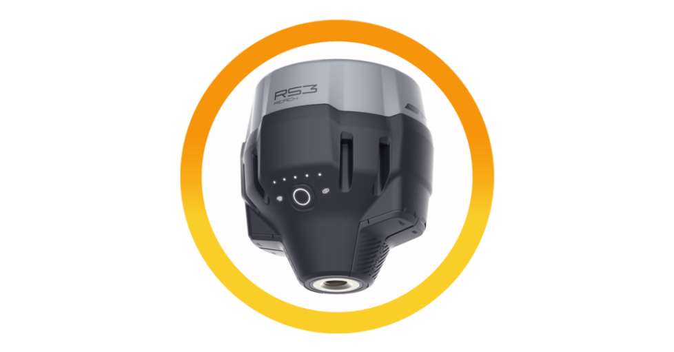
Reach RS3 Fully featured RTK receiver for surveying
Data collection with centimeter precision. Made for professionals.
RTK GNSS receiver with tilt compensation Perfect for land surveying, construction, and engineering tasks
IMU tilt compensation
Base and rover
Dual-band radio and NTRIP
RTK, PPK, and PPP
LTE modem and Wi-Fi
Key features
High-precision IMU
RTK
H:7mm+1ppm V: 14mm+1ppm
Tilt
RTK+2mm+0.3mm/”
Survey with under 20mm accuracy at up to 60 degrees of tilt. Reach RS3 is calibration-free and immune to magnetic, interference, so metal objects and electronics don’t affect
accuracy.
Get a Fix in 5 seconds
The receiver gets a cm-accurate solution in ~5 seconds and maintains robust performance even when the sky is partially obstructed or the unit is tilted. Signals tracked: GPS/QZSS, GLONASS, BeiDou, and Galileo.
Built-in LTE modem
Insert a SIM card into Reach RS3 and let it broadcast or receive corrections via NTRIP.
18 hours of work with tilt compensation
Battery lasts up to 22 hours in logging mode or 18 hours in RTK with tilt compensation. Charges via USB-C from a wall adapter or power bank.
RINEX logging and PPP support
Recording raw data in RINEX format for post-processing or working with OPUS, AUSPOS, and PPP services.
Rugged and compact
Dustproof and waterproof to IP67 with an operating temperature range of -20° to 65C (-4° to 149°F).
Technical Specs
Positioning
Precision
Static: H: 4mm+0.5ppm V: 8mm+1ppm
PPK: H:5 mm-0.5 ppm V: 10mm+1 ppm
RTK: H: 7mm+1ppm V: 14mm+1ppm
Convergence time: -5 s typically
Signal tracked: GPS/QZSS L1C/A,L2C, GLONASS L1OF, L2OF
BciDou B11, B21, Galilco E1-B/C, E5b
Number of channels: 184
Update rate: Up to 10Hz
IMU: 6DOF
Mechanical
Dimensions: 126 x 126 x 142mm
Weight: 950
Operating temperature: -20C to+65℃
Ingress protection: IP67 water and dustproof
Electrical
Autonomy: 18 hrs as an RTK rover with tilt compensation, 22 hrs of logging
Battery: LiFcPO4 6400mAh, 6.4V
Charging: USB Typc-C 5V 3A
Connectivity
LoRaradio
Transmit and receive
Frequency range: 868/915MHz
Power: 0.1V
Distance: Up to 8km
LTE modem
Regions: Global
Bands: FDD-LTE:1,2, 3, 4, 5,7,8, 12, 13, 18, 19, 20, 26, 28, 66
TD-LTE: 38, 40,41
UMTS (WCDMA/FDD): 1, 3,2, 4, 5,6, 8, 19
Quad-band,
850/1900,900/1800MHz
SIM card: Nano-SIM
UHF radio
Receive-only*
Frequency range: 410-470MHz
Protocol: TRIMTALK 4505″
Modulation type: GMSK
Wi-Fi: 802.11 b/p/n
Bluetooth: 4.0/2.1 EDR
Ports: RS-232, USB Type-C
Data protocols:
Corrections: NTRIP. RTCM3
Position output: NMEA, LLH/XYZ
Data logging: RINEX, NMEA, LLH/XYZ, UBX
Internal storage: 16G
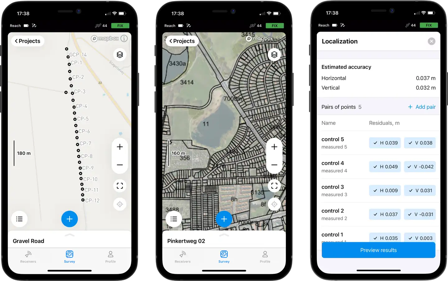
iOS and Android Emlid Flow
The Emlid Flow mobile app manages all field-related tasks, including receiver configuration, RINEX logging, data collection, and stakeout
- Points, lines, and polygons
- Localization and base shift
- Survey codes
- Geometry calculations
- Surfaces and cut & fill
- Stakeout reports

any browser Emlid Flow 360
With the cloud-based Emlid Flow 360, you can instantly share data between the field and the office.
- Prepare and manage projects
- Always have a backup of your work
- Make simple edits right in the browser

Join Us in Shaping the Future of Mining
Subscribe now to receive updates from Dwyka Mining Services (Pty) Ltd. Connecting you to projects and the mining industry directly in your inbox.


